


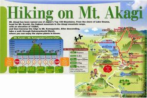
Hiking on Mt. Akagi
Mt.Akagi has been named one of Japan's Top 100 Mountains.
From the Shore of Lake Onuma,head for Mt. Kurobi,the Highest mountain in the Akagi Mountain range, with an elevation of 1828 meter,and then traverse the ridge to Mt. Komagatake.
After descending,take a walk through Kakumanbuchi Marsh, where you can enjoy the alpine plants in Bloom.
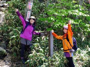
Start (recommended) your journey starts here!
The Akagi Visitors Center
Telephone: 027-287-8402 (sorry, japanese dialogue only)
Materials related to Mt. Akgai's origin and the flora and fauna ground there are displayed here.
A shop and restaurant are located convenient base for hiking mountain climbing.
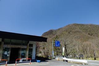
The visitors center is the base for Mt. Akagi sightseeing.
ADD
1 Fujimimachi Akagisan
ROUTE
Travel 30 minutes from JR Maebashi Station on the Kan-etsu Kotsu bus bound for Hujimi onsen, get off at the last stop and change to the Kan-etsu kotsu bus bound for the Akagiyama Visitors Center for 45 minutes, and get off at the last stop. The Akagi Visitor's Center is a short walk from the bus stop. (On Saturdays, Sundays and national holidays, a bus runs directly from Maebashi Station to the Center.)
OPEN
9:00 a.m. - 3:45 p.m.
CLOSED
Mondays (open every day in June, Summer Holiday Season, and in October. Irregular holidays from December - March)
PARKING
94 spaces
Offer a prayer at Akagi Shrine
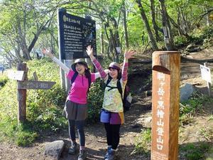
1. Mt.Komagatake Trailhead
If you pass the Mt. komagatake Trailhead, you’ll see the red sacred bridge of Akagi Shrine. The deity of Mt. Akagi is enshrined here, so be sure to visit the shrine before beginning your climb.
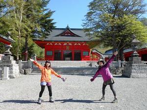
Akagi Shrine is located on Kotorigajima Island on the other side of the sacred bridge.
The deities of Mt. Akagi and Lake Onuma are enshrined in this shinto shrine.
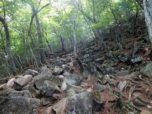
A rocky mountain trail
2. Mt. Kurobi Trailhead
As soon as you enter the mountain trail from the trailhead, located on a prefectural road, rocky path begins climbing steeply.
A small sign in the prefectural road marks the trailhead.
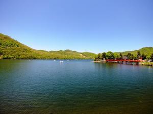
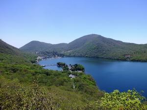
After crossing over Nekoiwa, you can see Lake Onuma and Akagi Shrine Below.
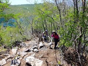
Use both hands to carefully climb the rocky trail. 90-100 minutes climb!
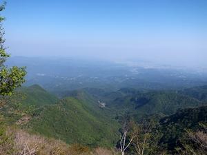
Enjoy the panoramic view
3. Summit of Mt. Kurobi
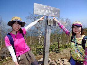
The View from Summit of Mt. Kurobi is blocked by the many trees that surround it.
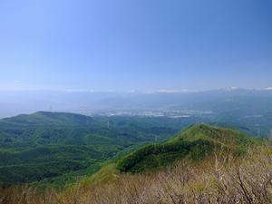
If you walk 5 minutes in the direction of north, in the weather is fine, you can see as far away as Mt. Tanigawa, Mt. Hotaka, and Mt. Sukai at view point.
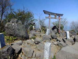
If you walk in the direction of Mt. Komagatake, you will see the torii of the Kurobi Okami Shrine.
From the near Summit, a panoramic view spreads out before you in the direction of Lake Konuma.
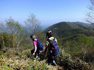
Hike along a mountain path - from Mt. Kurobi to Mt. Komagatake
As you walk along the ridgeline, the view is spectacular.
4. Summit of Mt. Komagatake
The View from Summit is blocked by the many trees that surround it, but the view as you descend the path is great. On the way, an iron stairway is built into the steep slope.
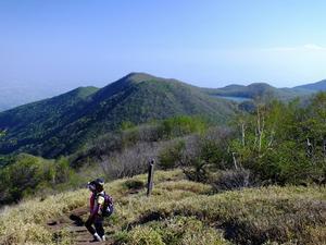
- You can see a panoramic view from summit of Mt. Komagatake, if the weather is fine.
Hike along a mountain path enveloped in Kuma bamboo grass.
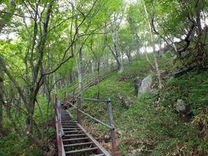
Iron stairway
Descend From the Mountain and head for Kakumanbuch Marsh.
5. Mt. Komagatake Trailhead
After descending the mountain and leaving the Mt. Komagatake Trailhead, the path to Kakumanbuch Marsh is a flat prefectural road, In June, road in Kakumanbuch Marsh is lined with the blooms of Japanese Azaleas.
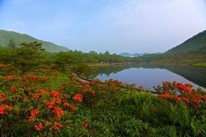
Return to the trailhead on the prefectural road, which you passed on the way. - Japanese Azaleas in Mid-June -
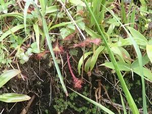
The trail runs along a marsh, which is a treasure house of alpine plants.
6. Kakumanbuch Marsh
At the center of this high moor is a marsh that is approx. 800 meters in circumference. the 2 kirometer walkway through the marsh is lined with peat moss, Japanese Azaleas (in Mid-June) and day lilies (in Mid-July).


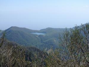
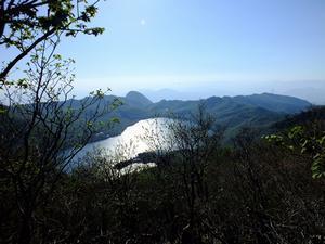
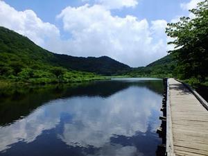
The view of Kakumanbuchi Marsh from Torii-touge Pass. Lake onuma is visible behind it.
Kakumanbuchi Marsh
地図
関連記事
この記事に関する
お問い合わせ先
文化スポーツ観光部 観光政策課
電話:027-257-0674 ファクス:027-212-7071
〒371-8601 群馬県前橋市大手町二丁目12番1号
お問い合わせはこちらから
更新日:2019年02月01日